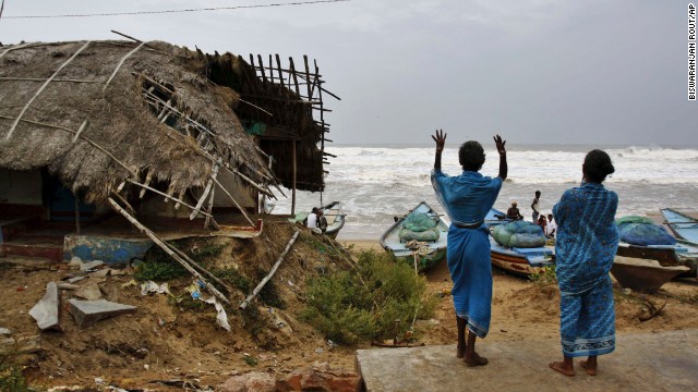
Preparations are under way on India's east coast ahead of Saturday's expected landfall of a massive cyclone now gathering strength in the Bay of Bengal.
Authorities are shuttling multitudes of people out of its path, following a practice developed after a similar cyclone killed thousands over a decade ago. They are giving residents no choice in the matter.
"We have taken a zero-casualty approach," said Odisha state disaster manager Kamal Lochan Mishra. "If people do not move, force will be used to evacuate them."
Tropical Cyclone Phailin is expected to make landfall somewhere near the border of Odisha and Andhra Pradesh states in India before 9 p.m. local time (about noon ET).
At least 440,000 people have now been evacuated from areas at risk, the country's National Disaster Management Authority vice-chairman, Marri Shashidhar Reddy, told reporters at a televised news conference early Saturday afternoon.
The storm's position in the Bay of Bengal is about 125 miles southeast from Gopalpur in the state of Odisha, Reddy said then.
The cyclone, which is packing sustained winds of 150 mph (about 240 kph) will bring a storm surge of as much as 6 or 7 meters (20-23 feet) in places, and threatens densely populated areas that are vulnerable to flooding.
Many of those evacuated from low-lying areas in Odisha left on foot or by bicycle, Mishra said. Evacuations will continue until Phailin roars ashore, he said.
They will be housed in nearly 250 emergency shelters set up in sturdy buildings like schools and government offices.
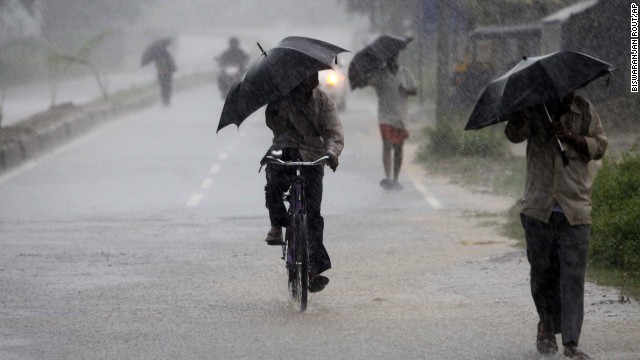
In Gopalpur, a coastal resort town, restaurants were shuttered and streets deserted Saturday afternoon, as rain lashed down.
Some fear a repeat of what happened on October 29, 1999, when Cyclone 05B, also known as the Odisha Cyclone, made landfall in the same area, causing the loss of more than 10,000 lives.
The strongest tropical cyclone recorded in the Bay of Bengal, it packed winds of 155 mph at landfall and caused more than $2 billion in damage.
Phailin will be less intense than that at landfall and is likely to weaken more as it moves on shore, but will still bring storm surges and dump heavy rainfall on inland areas for the next two days.
The eye of the storm, which has been getting smaller in size, is expected to pass over the city of Brahmapur. The third largest city on the east coast, Visakhapatnam, is further from the center of the storm but will also suffer strong winds.
Hurricane-force winds are expected to last until noon Sunday, and could extend several hundred kilometers inland as the storm moves into India.
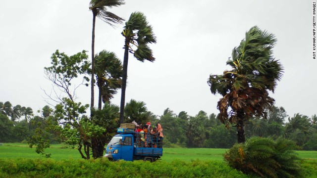

Disaster preparedness
International humanitarian organization World Vision said it was helping local community groups prepare for the cyclone's arrival.
"In a storm of this magnitude there is the potential for widespread damage to crops and livestock in the low-lying coastal areas and houses completely wiped away," said Kunal Shah, the head of World Vision's emergency response in India. "So while we are praying this storm loses intensity, we're also preparing."
The organization has worked for the past several years to train local people in disaster preparedness, including search and rescue, basic first aid and how to protect livestock, and has thousands of emergency response kits ready to hand out where needed.
"We believe communities are better prepared than they were when the devastating cyclone hit in 1999," said Shah.
The force of the storm -- which is equivalent to a strong Category 4 hurricane -- could change the geography of the shoreline in places, creating inlets and eroding beaches, CNN forecasters said.

Rough seas, gales


The India Meteorological Department has warned that Phailin is a "very severe cyclonic storm" and urged the evacuation of coastal areas.
Gale-force winds are already whipping coastal areas of Odisha and north Andhra Pradesh and will continue to do so for hours after landfall, it said.
The storm surge could inundate low-lying areas of Odisha's Ganjam, Khurda, Puri and Jagatsinghpur districts and the Srikakulam district of Andhra Pradesh during landfall, it said.
Rainfall, some of it very heavy, started Friday in coastal Odisha and northern Andhra Pradesh. By Saturday evening inland areas of Odisha and west Bengal state will also get heavy rainfall, its forecast said.
Seas off the coast of Odisha and northern Andhra Pradesh are expected to become extremely rough as the cyclone approaches. Fishing operations are suspended, and all fishermen were advised to return to shore.
The meteorological department warns of extensive damage to so-called kutcha houses, those made of flimsy materials such as mud and bamboo, as well as some damage to old buildings.
Power and communication lines are likely to suffer large-scale disruption. Extensive flooding will also disrupt rail and road traffic, and crops are likely to suffer major damage, it said.
People in affected areas may be at risk from flying debris, as well as the flooding of escape routes. Residents are advised to stay indoors as the cyclone makes landfall, the forecast said.
CNN's Lonzo Cook reported from Gopalpur and Laura Smith-Spark wrote and reported in London. CNN's Harmeet Shah Singh, Tom Sater and Ivan Cabrera contributed to this report.
culled from cnn.com
No comments:
Post a Comment